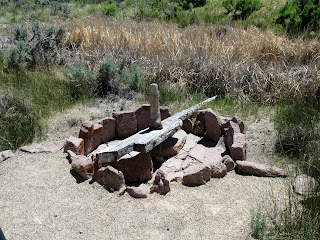
Due to poor planning on our part, we have found ourselves ready for lunch and nowhere to eat! So we figured if we had a good breakfast, we could do without lunch if we found nothing. We also made sure to fill up the truck since we have also found ourselves riding on fumes looking for a gas station! Unfortunately, this has happened more than once!
Today's destination was Cedar Breaks National Monument. It just opened last week due to the snow.
It's a smaller park, just 6 miles to drive through it, but what a gem! I would love to visit another time in July. They say the wildflowers are amazing here!
Our first stop was Point Supreme, which is also the Visitor Center. It had not opened for the season yet. As you can see from the sign, we were at 10,350 feet above sea level. Talk about thin air!
All these beautiful sights, we are finding we like Utah more and more.
Our next stop was Sunset View Overlook, a little higher.
At Chessman Ridge, we could see some of the remaining snow in the canyon. It was only 54 degrees when we arrived at the park.
At the North View Overlook, there was even more snow left. Glenn had to get out on it! He tried to climb the snow bank, but didn't quite make it!
We were now at the northern boundary of the park. Just beyond the boundary was a gravel road that would lead us to the summit of Brian Head. Well, almost the summit, not all of the snow had been plowed off the road and we had to turn around before we got to the top.
 |
| Marmot or Pika? |
 |
| End of the road |
The descent from Brian Head to Parowan was a steep one! I think this is one of the steepest grades we've been one. We came down a good 5-6,000 feet in not too many miles.
Once we arrived in Parowan, we decided to find the petroglyphs at Parowan Gap. But first we needed to get some water! Between the low humidity and altitude, you dehydrate easily. We found a Maverick gas station and they were grilling burgers and 'dogs outside the store. There's lunch! So after refueling and rehydrating ourselves, we were off on our next adventure for the day.
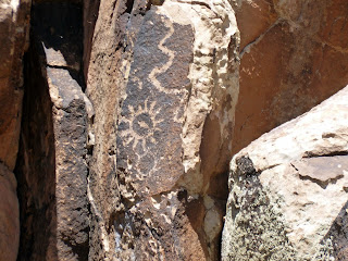
Parowan Gap is a 3 mile long pass that connects Parowan and Cedar Valleys. It is a classic example of a wind-gap. It is an unusual geological landform marking where an ancient river cut a 600 foot deep notch through the Red Hills. But what makes it really remarkable is the 90+ panels with 1500 figures carved in the rocks. They may be as old as 5,000 years.
 |
| This is the "Zipper Glyph". Some researchers believe it is a solar calendar. |
Aren't these cool?! We wanted to turn over the fallen rocks to see if there were more underneath! These were so fascinating and Glenn was really happy I had read about this place!
We drove back to Cedar City, stopped in at the Visitor Center to get some directions, and took off to find the Iron Town Ruins.
 |
| We had a cow detour |
 |
| Charcoal Kiln |
 |
| Remains of foundry buildings |
 |
| Prickly Pear Cactus in bloom |
 |
| Arrastra - Horses were hooked up to this to grind limestone |
This was the county's second attempt at iron mining back in the 1870's. Utah still has one of the richest iron ore deposits.
We went back to the motel, ordered Papa John's pizza, and finished off this wonderful day with a dip in the hot tub!


No comments:
Post a Comment